Where is Uganda; Location, Map, and Facts | Country Profile
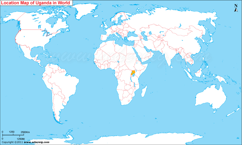
where is Uganda? The indicated location for Uganda reveals that it is situated in the eastern region of the continent of Africa. Uganda’s international borders are shared with Kenya in the east, Sudan in the north, the Democratic Republic of the Congo in the west, and Rwanda and Tanzania in the south, according to a map of the country. The enormous Lake Victoria, however, is located in the south of the nation. An interesting nickname for Uganda is “Pearl of Africa.”
Where is Uganda Located?
Kampala, the country’s capital, is situated in the south-central region. In 1962, the county gained its independence. Uganda’s form of government is a presidential republic with a multi-party system. The President of Uganda is the head of state and the head of government under this political structure. It belongs to the Organization of the Islamic Conference, the Commonwealth of Nations, the African Union, and the East African Community.

Where is Uganda Located on the World Map
The nation’s economy also heavily depends on the mining and agricultural sectors. The majority of the nation’s exports are coffee. Copper and cobalt are two of the country’s natural resources. Additionally, the nation contains untapped quantities of natural gas and crude oil.
Quick Facts about Uganda
Geography Now! Uganda
Country – Uganda
Continent – Africa
Where Is Located – Uganda is a country located in Eastern Africa
Coordinates – 1.0667° N, 31.8833° E
Capital – Kampala
Largest City – Kampala
Neighboring Countries – Democratic Republic of the Congo, Kenya, Rwanda, South Sudan, Tanzania
Administrative divisions – 111 districts and 1 capital city
Area – 241,038 sq km
Population – 34.51 million (2011)
Official Language – English (Official), Ganda, Arabic
Currency – Ugandan shilling (UGX)
ISO Alpha-2 Code – UG
ISO Alpha-3 Code – UGA
ISO Numeric Code – 800
GDP – $50.439 billion 2012 estimate
Calling code – 256
Time Zone – EAT (UTC+3)
Internet TLD – .ug


